Weathernews announces "New Year's weather" The cold wave struck after Christmas, and the peak of cold air is December 27
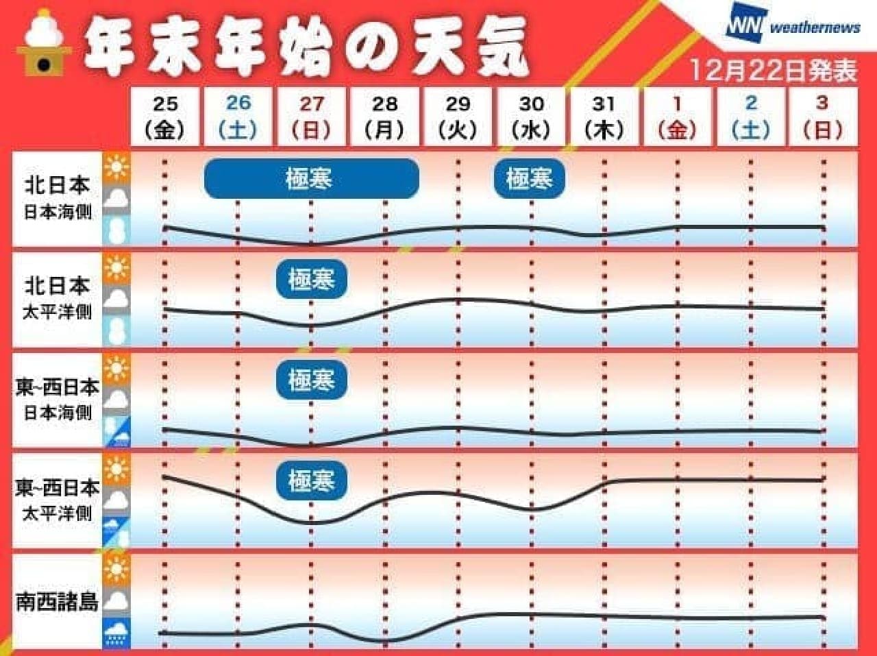
■ Year-end and New Year weather (December 25-January 3)
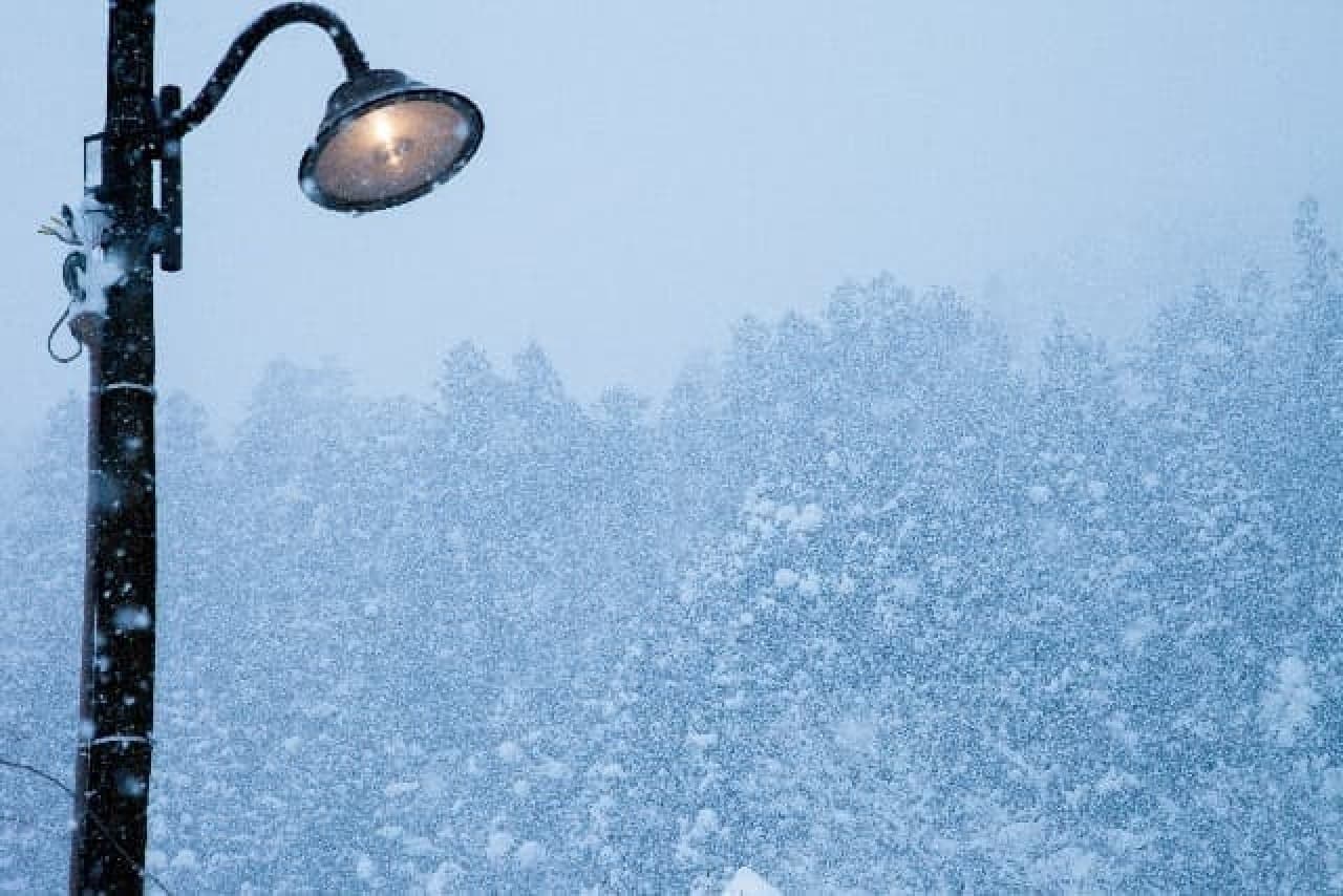
◆ Cold wave hits after Christmas
During the year-end and New Year holidays, there are many days with winter-type pressure distribution, and it is expected that it will snow mainly on the Sea of Japan side of northern Japan. The peak of cold air is on the 27th, and heavy snow and blizzards will occur from the Sea of Japan side of northern Japan to Hokuriku, which may affect transportation. Also, be careful of strong winds on the Pacific side of northern Japan. If you plan to return home this weekend, please check back often for the latest information.
Not only in northern Japan and Hokuriku, but also in northern Kinki and the flatlands of the Sanin region, there is a possibility that snow will be mixed with rain in the Norio Plain and Keihanshin such as Nagoya City. There are many sunny places on the Pacific side such as the Kanto region, but it is expected to be severely cold.
After the 28th, the chills have passed the peak and the chills have eased a little, but the Sea of Japan side of northern Japan continues to have snowy days. On the other hand, on the Pacific side of northern and western Japan, there are many places where the third day of the new year is sunny, and it seems that the weather will be good for the first visit.
◆ Expectations are high on the Pacific side for the first sunrise!
On New Year's Day, you can see the first sunrise over a wide area on the Pacific side. On the other hand, it will snow and rain on the Sea of Japan side north of Hokuriku, and it is expected that the weather will be severe at the first sunrise. The sky is cloudy in the Sanin region and northern Kyushu, but there seems to be a chance to see the first sunrise through the clouds.
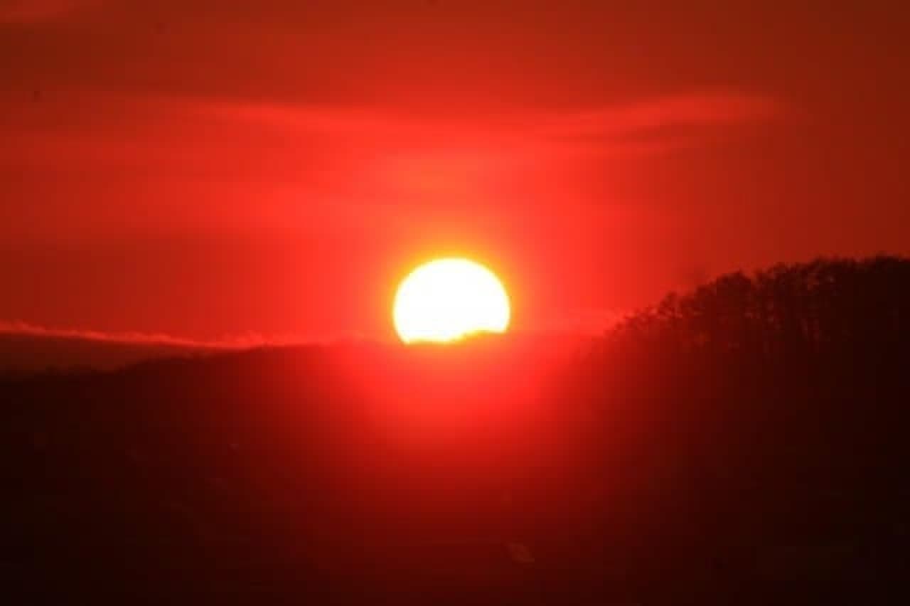
Can you see the first sunrise over a wide area on the Pacific side?
The forecast announced this time is based on the information as of December 22nd. For the latest information, refer to "Notice" of the smartphone app "Weathernews Touch" and "Year-end and New Year weather Ch." Of the PC site "Weathernews".
■ Year-end and New Year weather-By area-
◆ Hokkaido-Winter storms this weekend, pay attention to the impact on transportation when returning home
During the year-end and New Year holidays, there are many days with winter-type pressure distribution, and it snows mainly on the Sea of Japan side. On the 27th, the strongest cold air will flow in during this period, and heavy snow and blizzards on the Sea of Japan side and winds on the Pacific side may affect transportation. Please check the latest information frequently when you move home.
Even after the 28th, the sky is as snowy as the Sea of Japan side, but it will not be as rough as on the 27th, and the first sunrise will be visible on the Pacific side.
◆ Tohoku-Winter storms this weekend, pay attention to the impact on transportation when returning home
During the year-end and New Year holidays, there are many days with winter-type pressure distribution, and it snows mainly on the Sea of Japan side. On the 27th, the strongest cold air will flow in during this period, and heavy snow and blizzards on the Sea of Japan side and winds on the Pacific side may affect transportation. Please check the latest information frequently when you move home.
Even after the 28th, the sky is as snowy as the Sea of Japan side, but after the peak of cold air, there are days when it rains instead of snow in the southern part of Tohoku. It will not be as rough as on the 27th, and the first sunrise will be visible on the Pacific side.
◆ Hokuriku-Snow cover in the plains this weekend, pay attention to the impact on transportation when returning home
During the year-end and New Year holidays, there are many days with winter-type pressure distribution, and cold rain and snow fall. On the 27th, the strongest cold air will flow in during this period, and it will snow as much as it accumulates in the plains, and heavy snow is expected along the mountains. The wind is strong and the visibility may be impaired by the snowstorm, which may affect the transportation system. When you move home, please check the latest information frequently.
After the 28th, the chills have weakened, and there are days when it rains in the plains.
◆ Kanto / Koshin-New Year holidays with many sunny days! New Year's Day is expected to be the first sunrise
In the central and southern parts of Kanto, Yamanashi and Nagano prefectures, there are many sunny days due to the winter-type pressure distribution during the year-end and New Year holidays, and New Year's Day can be expected to be the first sunrise. This weekend, when the coldest weather is the strongest during this period, the temperature will drop and it will be extremely cold. From New Year's Eve to the beginning of the year, it will be sunny in winter, and the third day will be a good day for the first visit.
However, heavy snowfall will occur along the mountains in northern Nagano Prefecture and northeastern Kanto, mainly on the 27th when the cold weather intensifies, and there is a possibility that it will snow in Nagano City as well.
◆ Tokai-The peak of the year-end and New Year chills is this weekend! There is a possibility that rain will be mixed with snow in Nagoya city. Even in the Ohira plain, cold rain can be mixed with snow. You don't have to worry about the impact on transportation, but you need to be careful about your physical condition as it gets colder.
There are many sunny days after New Year's Eve, and it seems that the weather will be good for the first sunrise and the first visit on the third day.
◆ Kinki-The peak of the year-end and New Year chills is this weekend! There is a possibility that the rain will be mixed with snow in Keihanshin. .. Also, in Keihanshin, there is a possibility that snow will be mixed with cold rain. There is not much concern about the impact on transportation, but it will be very cold, so you need to be careful about your physical condition.
After the 28th, the snow in the north will gradually turn into rain, so be careful of the deterioration of the road surface condition. On the other hand, there are many sunny days after New Year's Eve in the central and southern parts of the country, and it seems that the weather will be good for the first sunrise and the first visit on the third day.
◆ China-The peak of the year-end and New Year chills is this weekend! Even on flat ground, it snows in the Sanin region, and in the Sanyo region, it is extremely cold. This weekend is the coldest of the season, and it may snow not only in the mountains of China but also in the flatlands of the San'in region. Especially on the 27th, clouds will flow into Sanyo, and it seems that there will be temporary rain and snow.
After the 28th, the peak of cold air will pass and the snow will gradually turn into rain, so be careful of the deterioration of the road surface condition in the Sanin region. Sanyo will be the year-end and New Year holidays with many sunny days, and it seems that the weather will be good for the first sunrise and the first visit to the third day.
◆ Shikoku-The peak of the cold air during the year-end and New Year holidays is this weekend, and there is a possibility of snow in the mountains . This weekend, the coldest weather will be the strongest during this period, and it will snow in the Shikoku Mountains. Especially on the 27th, clouds tend to flow into the flatlands of Setouchi, and it seems that there will be temporary rain and snow.
After the 28th, the peak of chills has passed and the chills have eased a little. After New Year's Eve, there are many sunny days to go out, and it seems that the weather will be good for the first sunrise and the first visit on the third day.
◆ Kyushu-The peak of the cold air during the year-end and New Year holidays may be snowing in the mountains this weekend. .. This weekend is the coldest of the season, with the possibility of snow in the Kyushu Mountains.
After the 28th, the peak of chills has passed and the chills have eased a little. New Year's Eve-Sanga Day is likely to be a good day for going out for the first visit. On New Year's Day, the southern part with less clouds has a higher chance of seeing the first sunrise, and it is possible that it can be seen through the clouds in the northern part.
◆ Nansei Islands-The weather will recover during the New Year's Eve, and it will be easier to spend the year-end and New Year holidays if it rains. .. After that, the weather will not be clear, but it will be difficult to rain at the end of the year.
New Year's Eve to San is a cloudy but calm sky, and on New Year's Day, the first sunrise may be seen through the clouds. Due to the strong cold air, a cold wind blows around the 27th, and it becomes severely cold, but after that, the temperature rises from normal to higher than normal, and it seems that it will be easier to spend when the sun reaches.
![3COINS] A must-see for working women. 5 items you want to use at work & keep in your bag 【Selected by 30s editorial department members】.](https://image.enuchi.jp/upload/articles/14098/5bdf8f75474c3d5ba782c10f1fe066a0_special.jpg)


![[Housework hack] Convenient for kitchen ♪ 3 ways to use milk carton--For ice molds and curry storage containers, as well as big ice packs](https://image.enuchi.jp/upload/articles/8734/bee06672693607781fb090bbea290002_special.JPG)


![Convenience store petit-price cosmetics] AND by ROM AND "Mellow Stick Blush" and "Glassy Milky Tone Up" at LAWSON.](https://image.enuchi.jp/upload/articles/14192/eca9c3cd72c87b0c6ae58c7c3d48661f_related.jpg)